The Gateway to the Red Peaks
Czerwone Wierchy (The Red Peaks) constitute one of the most famous and breathtaking ridge walks in the entirety of the Tatra Mountains.
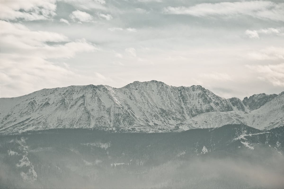
Ciemniak (2,096m) is the westernmost peak of this massif and serves as the primary gateway for hikers attempting the full four-peak traverse. The ascent is notorious among local highlanders for being a relentless, grueling climb, but the physical toll is instantly forgotten the moment you breach the treeline and witness the sweeping, unobstructed panoramas. From here, the world opens up, revealing the jagged peaks of the High Tatras to the east and the gentle, rolling hills of the Slovak Orava region to the west.
1. Anatomy of the "Red" Landscape: Botanical Magic
The name 'Red Peaks' is not derived from the rock itself—which is actually a pale, weathered limestone—but rather from a unique high-alpine plant called **Sit skucina** (*Juncus trifidus*). This hardy, grass-like rush is a survivor of the Ice Age, clinging to the thin, acidic soil of the granite-limestone contact zone. In the late summer and specifically during September and October, the chlorophyll in the plant retreats, and it begins to accumulate pigments that turn the entire expansive ridge into a blazing carpet of rust, copper, and deep crimson. This transformation is most intense on the gentle slopes of Ciemniak. When the western sun hits the grass at a low angle during the "Golden Hour," the entire mountain seems to glow with an inner fire, creating a visual spectacle that feels more like the surface of a distant planet than a European mountain range.
2. History: The Peak of Smugglers and Shepherds
For centuries before it became a playground for hikers, Ciemniak was a vital node in the "Goral highway" of the high mountains. Until the mid-20th century, the high meadows were used for sheep grazing, and the **Chuda Przełęcz** pass was a key transit point for shepherds moving flocks between the Polish and Slovak sides. More interestingly, the ridge was a notorious haven for smugglers. Because the border runs directly along the summit, nimble-footed highlanders would carry illegal salt, tobacco, and alcohol across these peaks at night to evade the Austrian and Hungarian customs officers. The small stone cairns you see today are successors to the "smuggler's signs" once used to navigate the ridge in thick mountain fog.
3. The Ascent: Conquering the Chuda Turnia
The most popular and direct route to Ciemniak begins in the Kościeliska Valley (Kiry). You follow the green trail, immediately beginning a steep, switchbacking ascent through dense spruce forests. This is a "lung-buster" section where the trail gains over 1,000 meters of elevation in just a few kilometers. After about two hours of heavy climbing, you will reach the **Chuda Przełęcz** (Thin Pass) and the distinctive rock formation known as **Chuda Turnia** (1,858m). This limestone tower serves as a natural balcony, offering the first real look at the massive depths of the Miętusia Valley below. From here, the trees vanish completely, replaced by open alpine meadows and wind-sculpted rocks.
4. A Bridge Between Nations: The Borderline
The summit of Ciemniak marks a significant geopolitical point. The international border between Poland and Slovakia runs directly across the peak, marked by small, weathered granite obelisks with a "P" on one side and an "S" on the other. Today, you can stand with one foot in each country, looking down into the untouched Slovak **Tomanowa Valley**—a strictly protected nature reserve where human presence is minimal and the wild Tatra ecosystem remains exactly as it was thousands of years ago.
This is a full-day, high-altitude expedition (7-9 hours) with **zero shelters** once you leave the valley floor. Pre-planning is the difference between a spiritual experience and a dangerous struggle.
- The Highest Prayer Mat: The summit plateau of Ciemniak (2,096m) is the highest flat point in the Western Tatras. It is incredibly serene and offers a profound sense of *Khushu* (devotion). Because the wind can be fierce, we recommend using your backpack or small rocks to secure your prayer space. Praying with the entire High Tatra range as your *Qibla* backdrop is a spiritually transformative memory.
- The "Thirst" of the Limestone: There are no streams or springs above the tree line. The porous limestone rock swallows all water instantly. Do not attempt this hike with less than 2.5 liters of water per person. We recommend performing Wudhu at the trailhead in the Kościeliska Valley before starting the climb.
- Mountain Provisioning: Pack calorie-dense, Halal-friendly provisions. Local smoked sheep's cheese (*oscypek*), which can be bought at the shepherds' huts (bacówki) at the start of the trail, is the perfect high-altitude fuel as it provides both protein and essential salts to prevent cramping.
5. Wildlife: The Masters of the West
Ciemniak is one of the best places in the Western Tatras to spot the **Tatra Chamois** (*Kozica*). Because this peak is slightly less crowded than the central summits like Kasprowy Wierch, these shy mountain goats often graze right next to the trail on the Slovak side of the ridge. You may also spot the **Alpine Marmot** (*Świstak*) basking on flat stones near the **Chuda Turnia** rock tower. These creatures are vital indicators of the mountain's ecological health. Finally, keep your eyes on the thermal currents—it is common to see the **Golden Eagle** patrolling the skies above the Miętusia Valley, looking for its next meal.
6. Navigation: The Long Ridge Traverse
While reaching Ciemniak is an achievement in itself, many hikers choose to continue east along the ridge. The path connects to **Małołączniak**, **Krzesanica**, and **Kopa Kondracka**. This full ridge traverse offers uninterrupted views for over 5 kilometers, with vertical drops of several hundred meters into the Polish valleys. However, be warned: the ridge is extremely dangerous in thick fog or lightning. There are no safe descent paths between the peaks, so once you commit to the ridge, you must be prepared to finish the entire traverse or double back the way you came.
7. Safety: The Descent Hazard
While the climb is physically taxing, the descent from Ciemniak via the **Ratusz Litworowy** can be hard on the knees. The trail consists of loose limestone scree and steep, polished steps. We highly recommend using trekking poles to save your joints. Additionally, check the weather forecast for "Halny" winds—on this exposed ridge, a strong wind can literally blow a hiker off balance. Respect the mountain, and it will reward you with the most majestic views in Central Europe.
Ahmed's Local Secret
Everyone waits for the "Red" in late September, but if you go in the first week of October, the contrast between the blood-red grass and the first light dusting of white snow on the High Tatras in the distance is the real prize. My second secret: don't descend the way you came. The route down to **Dolina Tomanowa** is significantly easier on the knees and much more likely to have a bear or chamois sighting because it's so much quieter than the Kiry side. Just make sure you have enough daylight, as it's a longer trek back through the valley floor.